
The straightenings of the Semois river
The water issue
In addition to the mardelles and the crons, a characteristic of the municipality of Etalle is that it is crossed by the Semois river.
But on this Jurassic terrain, as opposed to the Semois in Ardenne, which is very deep, the Semois in Gaume is a plain river, sloping very gently, of the order of only 1 to 2 meters per kilometer of river.
Because of this little slope, it suffers from a serious excess of stagnant water, aggravated by two other causes: the impermeability of the subsoil, composed of clay and clayey marls and the sinuosity of the watercourse, caused mainly by the geological structure of the land (presence of easily erodable rocks), by the relief and by the presence of tributaries.
Once the sinuous path has begun, the inertia of the water gradually accentuates the meanders.
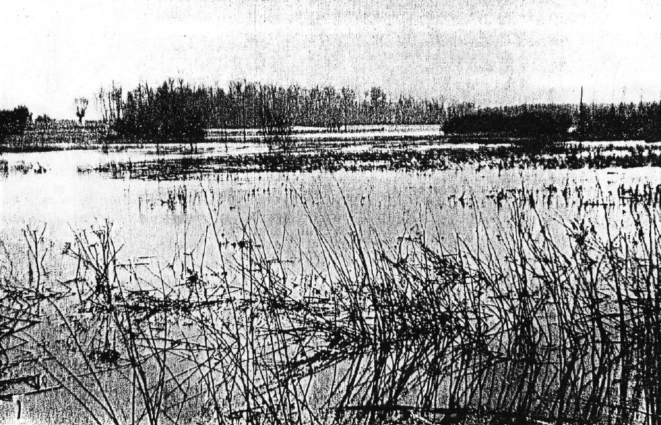
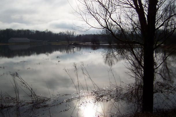
The slowness of the river therefore caused the deposition of silty sediments which cluttered the bed of the river, causing frequent flooding and the loss of unusable land for agriculture.
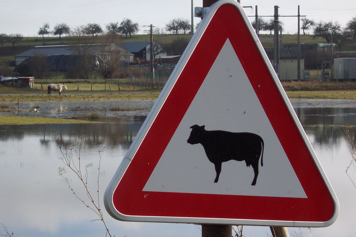
Dozens of hectares then disappeared under a vegetation of marsh grasses and cold mists created real nuisances for the residents.
Both for the livestock and for the residents, therefore, there was a serious health problem.
It was therefore necessary, according to the authorities at the time, to improve the course of the Semois and, much more than a cleaning, it was necessary to rectify, widen and deepen the river.
First initiatives by Henri Henriquez in Villers-sur-Semois
 The first known local work was carried out around 1710-1712 in Villers-sur-Semois by Henri Henriquez, child and lord of the place.
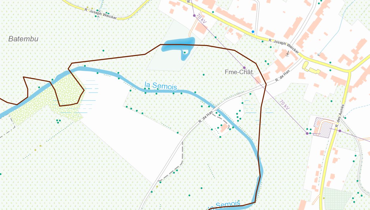
The primitive Semois (in brown on the figure, on the current map) passed very close to its castle. Was he embarrassed by this proximity or was he worried about the fate of the population?
 Anyhow, he decided to correct, in front of the village, this vast curve of the river by a channel stretched between the two ends of the arch.
He had an agreement for this by letter patent grant from King Philip V of Spain on June 1, 1710:
"Granted as we hereby grant special grace in consideration and for the ease of the exchanges between lords a trade that he can and will be able to build at said place of Villers-sur-Semois at his costs and expenses a bridge and path that is at all times and diverting the course of the said Semoy river by a canal of four hundred toisses or surroundings in length by six in width and to make for this purpose the roadway or raised from the ground by him proposed of the same length across the former course of the said river "
But this shortcut was established at a level higher than that of the natural course, so that the floodwaters returned to the original bed.
 So, a 350-meter-long bypass arm was dug between the old bed and the new one, to relieve the flow of the latter.
Large-scale work at the end of the 19th century
 But this small local initiative did little to solve the flooding and fog problems.
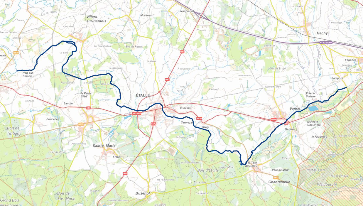
The Semois remained very tortuous throughout its course in the current municipality of Etalle.
In 1890, an official request to the Belgian parliament concerns the straightening of the course of the Semois river between Villers-sur-Semois and Tintigny.
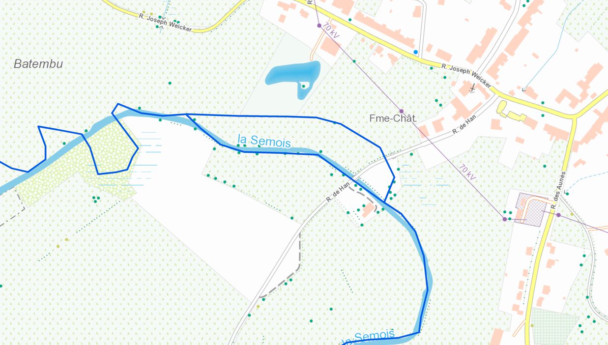
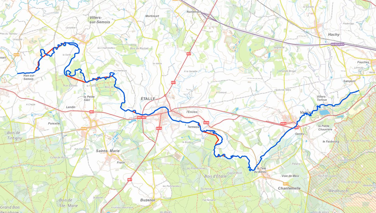 This was already a major job (in red on the figure), carried out on the initiative of François Hippolyte Braffort, originally from Villers-sur-Semois, then provincial clerk, future deputy, so that the length of the course of the river in the former municipality of Villers-sur-Semois, for example, was reduced by 1,875 meters, or about a quarter of its length in this municipal sector.
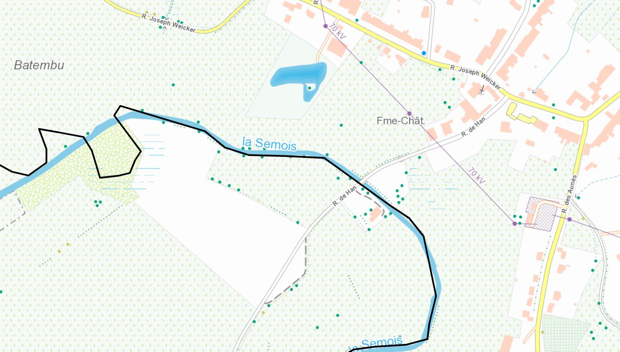
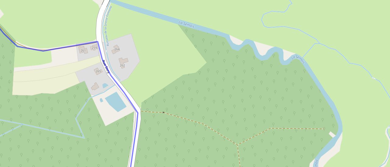
Around Villers-sur-Semois, we note the straightening to the west of the road to Han.
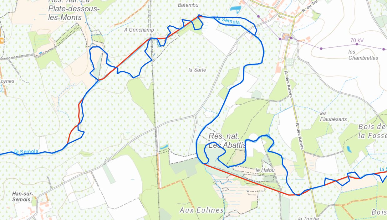
But also the one who left free "the old bed of the Semois" at Abattis.
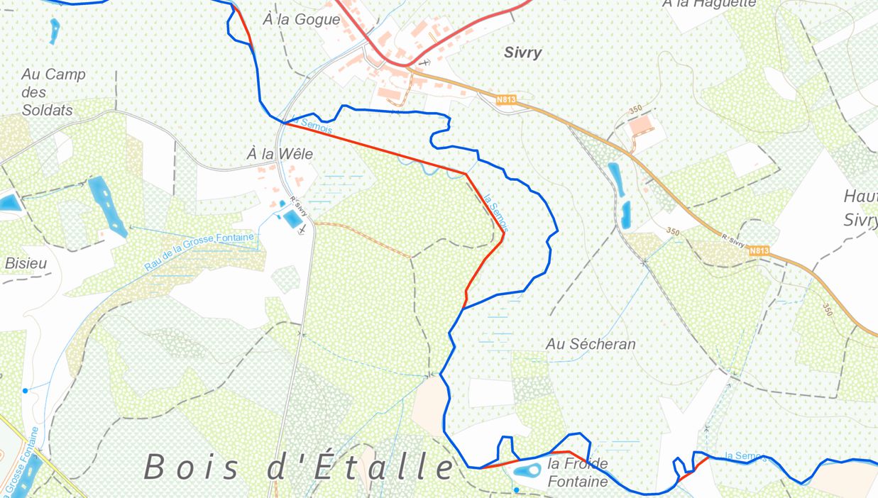
At the same time, we also note the straightening of the river south of the village of Sivry.

Between Vance and Villers-Tortru, the straightening works will take place later.
On the 1922 map, the meanders of the primitive part coexist with the straightened part (in orange in the figure).
Later, "the former Semois" will no longer be part of the river bed.
Between its original route and its current route, the river has lost more than 4 km, leaving here and there "dead arms".
Did this important rectification work improve the situation?
After all these works, the floods were not suppressed so far and the low meadows remained in the state of a kind of swamp.
In addition, the specifications of the municipality of Villers required local residents to carry out painful cleaning work on the river bed, to rid it of its abundant vegetation and the deposits of earth carried by the rains.
What had escaped the technicians of the time was the presence of a rocky plug at Breuvanne (Tintigny) which raised the water level of the Semois in the entire upstream sector and considerably restrained the flow of the course of the river.
It was therefore necessary to remove this rocky plug, then, as a result of this removal, we could profitably deepen the bed of the river upstream.
It was still necessary to wait half a century that we saw the realization of this plan.
In 1948, at the initiative of Paul François, mayor of Villers-sur-Semois and deputy to Mr Orban, Minister of Agriculture at the time, several works to improve the course of the Haute Semois were undertaken.
The rocky plugs of Breuvanne were dynamited and some meanders were further straightened in order to encourage the departure of the water.
In addition, the study of the ground had detected the places where spread layers of quicksand.
These delicate points were sealed by the establishment of solid stone walls supported at the base by a parapet of juxtaposed piles well established in the basement.
And yet, still in 1962, the mayor of Villers, Camille Lemaire, still alerted the authorities to the recurring problems in his village, and in particular the silting up of the drainage canal put in place during Henri Henriquez's time.
And even now, the Semois in Villers overflows regularly, as shown by photos taken in January 2009.
Some people qualify as devastating the effects of these cleaning and straightening works which have profoundly altered the wetlands located along the Semois.
We are talking about the loss of biodiversity and the "natural" aspect of the river.
An attempt to restore the former meanders was even attempted in Sivry, then abandoned.
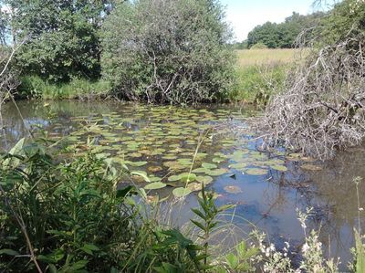
And yet, the "dead arm" of Abattis and the marshes which surround it are among the most remarkable wetlands of Belgian Lorraine.
The straightening work of the Semois caused the isolation of this branch supplied by sources whose purity contrasts with that of the Semois.
Actually, naturalists prefer to use the expression "former arm" rather than "dead arm", as the fauna and flora are very rich and alive.
I would like to take this opportunity to make a very personal little comment as a former environmental teacher.
Having to temporarily organize field trips for a course on biodiversity in the absence of the designated teacher, I called in outside specialists who kindly offered me some interesting sites.
And I was struck to note that all these proposals concerned old sites exploited by the man, even "altered" by the man.
Thus, former abandoned quarries are often of significant biological interest, as evidenced by the presence of certain species of bats.
Bare soils, devoid of any vegetation at the start, are favorable places for the establishment and development of specialized pioneer plants.
Bare cliffs constitute substitute environments for species growing on rocks, or, in the case of loose rocks, favorable environments for the nesting of birds, such as the bank swallow, or burrowing insects, such as solitary bees and wasps.
Often, during operation, the excavations are partially inundated by the flush water table.
The presence of water features further adds to the biological interest of abandoned quarry sites.
We can also cite forest areas cleared by man on which pioneer species are reborn which heal these disturbed environments,
or the marshy areas formerly exploited for peat and which have become nature reserves.
This is the case with these arms of the river that should not be described as "dead".
It is therefore curious, even paradoxical, to note that those who oppose the establishment of human activity are also the first to want to preserve such and such a bare clearing, such disused building, such old river bed or such abandoned quarry.
What can we suggest to preserve these areas of ancient arms of the river that are both rich and fragile?
Current initiatives go in the direction of the creation of "wateringues", that is to say associations of owners and public administrations, responsible for ensuring a favorable water regime for agriculture and hygiene, as well as land defense against flooding.
Thus, Étalle has 3 perimeters of wateringues:
- The wateringue of Fratin, which is made up of three groups around the villages of Fratin and Sainte-Marie-sur-Semois;
- The wateringue of Gilbaupont, on both sides of the border with the municipality of Tintigny at Sainte-Marie-sur-Semois;
- The wateringue of Houdemont, north of Mortinsart, extending towards the village of Houdemont (municipality of Habay).
So, let's continue to be optimistic and to see, sometimes, in these "disturbances" of nature, some elements that promote biodiversity ...
Bibliography
- Tandel, E. Les communes luxembourgeoises. Tome III - L'arrondissement de Virton.- Annales de l'Institut Archéologique du Luxembourg - Arlon - tome 23 - 1890
- François, P., Habran, L. La Wateringue du bassin de la Semois jurassique. Etude agraire et sociale- Alliance agricole - 22 juin 1963
- Thoen, D. Intérêt biologique et patrimonial de l'ancienne sablière sinémurienne de Villers-Tortrue - Natura Mosana vol.53 n°2 - Avril-Jin 2000